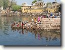
Město: Nimmakhandipenth, Region: Orissa
|
Navigace mapy Celého Světa online: Kliknutím a tažením na mapě Celého světa, nebo použijte zoom kontrol.
Zeměpisná šířka: | 19,3500 (19°21'0.000"N) |
Zeměpisná délka: | 84,4833 (84°28'59.880"E) |
Nadmořská výška: | 84 m |
|
| |
|
|
|
|
GMT čas: +5,5 hodin | Posun oproti ČR: +5,5 hodin |
Vzdálenost města Nimmakhandipenth do 25 největších měst státu: Indie (cestopis)
|
Přímá vzdálenost | Km |
| Nimmakhandipenth - Bombay | 1 225 km |
| Nimmakhandipenth - Delhi | 1 272 km |
| Nimmakhandipenth - Bangalore | 1 022 km |
| Nimmakhandipenth - Calcutta | 540 km |
| Nimmakhandipenth - Madras | 829 km |
| Nimmakhandipenth - Ahmadabad | 1 296 km |
| Nimmakhandipenth - Hyderabad | 671 km |
| Nimmakhandipenth - Pune | 1 120 km |
| Nimmakhandipenth - Surat | 1 222 km |
| Nimmakhandipenth - Kanpur | 898 km |
| Nimmakhandipenth - Jaipur | 1 222 km |
| Nimmakhandipenth - Lakhnau | 910 km |
| Nimmakhandipenth - Nagpur | 596 km |
| Nimmakhandipenth - Indore | 973 km |
| Nimmakhandipenth - Patna | 698 km |
| Nimmakhandipenth - Bhopal | 853 km |
| Nimmakhandipenth - New Patna | 698 km |
| Nimmakhandipenth - Ludhiana | 1 550 km |
| Nimmakhandipenth - Thana | 1 209 km |
| Nimmakhandipenth - Agra | 1 093 km |
| Nimmakhandipenth - Vadodara | 1 218 km |
| Nimmakhandipenth - Gorakhpur | 1 433 km |
| Nimmakhandipenth - Nasik | 1 121 km |
| Nimmakhandipenth - Pimpri | 1 126 km |
| Nimmakhandipenth - Faridabad | 1 245 km |
Vzdálenost města: Nimmakhandipenth do Top 10 měst světa
|
Přímá vzdálenost | Km |
| Nimmakhandipenth - Praha | 6 957 km |
| Nimmakhandipenth - Berlín | 7 042 km |
| Nimmakhandipenth - Londýn | 7 971 km |
| Nimmakhandipenth - Los Angeles | 13 612 km |
| Nimmakhandipenth - Moskva | 5 610 km |
| Nimmakhandipenth - New York | 12 979 km |
| Nimmakhandipenth - Paříž | 7 838 km |
| Nimmakhandipenth - Peking | 3 806 km |
| Nimmakhandipenth - Rio De Janeiro | 14 609 km |
| Nimmakhandipenth - Sydney | 9 214 km |
| Nimmakhandipenth - Tokio | 5 668 km |
Podpořte nás ·
Kontakt·
Kniha návštěv ·
RoboStav
Copyright (c) 2025 by CELÝSVĚT. Všechna práva vyhrazena!
Kontaktní e-mail: celysvet(zav)email.cz