Město: Athelney, Region: Somerset

Zpět na článek: Velká Británie (cestopis)


Navigace mapy Celého Světa online: Kliknutím a tažením na mapě Celého světa, nebo použijte zoom kontrol.
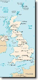
Zeměpisná šířka:

51,0564 (51°3'23.040"N)

Zeměpisná délka:

-2,9322 (2°55'55.992"W)

Nadmořská výška:

13 m

Článek: Velká Británie (cestopis)

Největší města: Velká Británie (cestopis)

Foto, fotky: Velká Británie (cestopis)

všechna města: Velká Británie (cestopis)

Fórum: Velká Británie (cestopis)

Největší města světa

Vzdálenost města Athelney do 25 největších měst státu: Velká Británie (cestopis)

Přímá vzdálenostKm
 Athelney - London  202 km
 Athelney - Birmingham  172 km
 Athelney - Glasgow  538 km
 Athelney - Belfast  441 km
 Athelney - Liverpool  263 km
 Athelney - Leeds  319 km
 Athelney - Sheffield  275 km
 Athelney - Edinburgh  545 km
 Athelney - Bristol  50 km
 Athelney - Manchester  276 km
 Athelney - Leicester  215 km
 Athelney - Coventry  179 km
 Athelney - Kingston Upon Hull  344 km
 Athelney - Cardiff  53 km
 Athelney - Bradford  314 km
 Athelney - Beal Feirste  441 km
 Athelney - Stoke-on-trent  222 km
 Athelney - Wolverhampton  178 km
 Athelney - Plymouth  112 km
 Athelney - Nottingham  244 km
 Athelney - Southampton  109 km
 Athelney - Reading  141 km
 Athelney - Derby  231 km
 Athelney - Dudley  171 km
 Athelney - Northampton  194 km

Vzdálenost města: Athelney do Top 10 měst světa

Přímá vzdálenostKm
 Athelney - Praha  1 231 km
 Athelney - Berlín  1 133 km
 Athelney - Londýn  202 km
 Athelney - Los Angeles  8 643 km
 Athelney - Moskva  2 698 km
 Athelney - New York  5 401 km
 Athelney - Paříž  448 km
 Athelney - Peking  8 313 km
 Athelney - Rio De Janeiro  9 122 km
 Athelney - Sydney  17 194 km
 Athelney - Tokio  9 706 km


Navigace: A B C Č D E F G H I J K L M N O P Q R Ř S Š T U V W X Y Z Ž VŠE

Podpořte nás · Kontakt· Kniha návštěv · RoboStav
Copyright (c) 2024 by CELÝSVĚT. Všechna práva vyhrazena!
Kontaktní e-mail: celysvet(zav)email.cz


Athelney
Athelney


Athelney
Athelney


Athelney
Athelney


Athelney
Athelney


Athelney
Athelney


Fotogalerie ()...


Přidat foto...


Poradna
Poradna
Poslední dotazy:
HELP !


IQ test online

Hry online
Svátek má  Ludmila, zítra Naděžda